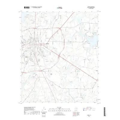
2019 Map of Athens
USGS Topo · Published 2019About this map
The city of Athens serves as the focal point of this East Texas survey, revealing a landscape defined by significant hydrological development and local family legacies. Numerous reservoirs and lakes, including the expansive Lake Athens to the east and smaller catchments like Chalmers Lake, South Nichols Lake, and Darby Farms Lake, punctuate the terrain. These water bodies are fed by a network of creeks such as First Caney Cr and Coon Cr. The map's genealogical value is anchored by several burial sites, including Richardson Cem near the city center, and Barker Cem and Davis Cem located in the rural fringes toward the settlement of Baxter. Infrastructure such as the Athens Municipal Airport and a dense network of Farm to Market roads like FM 317 illustrate the modern connectivity of this Henderson County seat.
Find a feature on this map
178 named features on this map. Tap any name to fly to it.
Don’t see what you’re looking for? This feature index may not catch every label — zoom into the map to look around manually.
Map Details
Editions of this 2019 Athens Map
This is the sole edition of this map. No revisions or reprints were ever made.
Other maps of this area

1948 · Brownsboro
USGS Topo · 1:62,500

1948 · Martins Mill
USGS Topo · 1:62,500

1949 · Martins Mill
USGS Topo · 1:62,500

1949 · Brownsboro
USGS Topo · 1:62,500

1949 · Frankston
USGS Topo · 1:62,500

1949 · Athens
USGS Topo · 1:62,500

1950 · Athens
USGS Topo · 1:62,500

1950 · Frankston
USGS Topo · 1:62,500

1956 · Tyler
USGS Topo · 1:250,000

1984 · Tyler
USGS Topo · 1:250,000