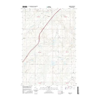
2016 Map of Atkinson
USGS Topo · Published 2016About this map
Atkinson and Mahtowa anchor this Carlton County landscape, where the Blackhoof River and Moose Horn River wind through a territory defined by a high concentration of glacial lakes. The settlement pattern follows the established corridors of Interstate 35, providing a modern contrast to the numerous family-named roads and rural infrastructure that mark the township lines. The map reveals a cluster of small water bodies, including Flodin Lake, Ellstrom Lake, and Sandy Lake, which dictate the local topography and placement of cemeteries like Bethel Cem and Sandy Lake Cem. To the southeast, the small locality of Duesler sits near the Elim Lutheran Cem, suggesting the long-standing community centers that formed around early church parishes. This 2016 survey documents the persistent rural character of the region, where hunters' grounds and local trails like Hizer Lake Rd continue to provide access to the area's dense wetland network.
Find a feature on this map
78 named features on this map. Tap any name to fly to it.
Don’t see what you’re looking for? This feature index may not catch every label — zoom into the map to look around manually.
Map Details
Editions of this 2016 Atkinson Map
This is the sole edition of this map. No revisions or reprints were ever made.
Other maps of this area

1949 · Holyoke
USGS Topo · 1:48,000

1953 · Duluth
USGS Topo · 1:250,000

1954 · Cloquet
USGS Topo · 1:24,000

1954 · Wrenshall
USGS Topo · 1:24,000

1954 · Atkinson
USGS Topo · 1:24,000

1954 · Iverson
USGS Topo · 1:24,000

1954 · Sawyer
USGS Topo · 1:24,000

1956 · Barnum
USGS Topo · 1:62,500

1958 · Duluth
USGS Topo · 1:250,000

1962 · Holyoke
USGS Topo · 1:62,500