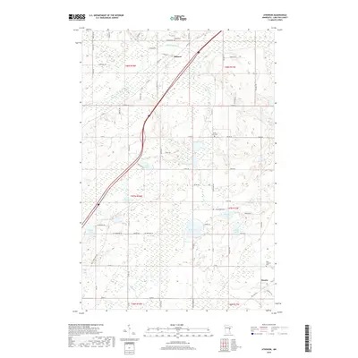
2019 Map of Atkinson
USGS Topo · Published 2019About this map
Atkinson and the surrounding wetland-rich terrain of Carlton County are defined by a complex network of glacial lakes and river systems. The Blackhoof River and Moose Horn River wind through the township, interspersed with numerous water bodies like Sandy Lake, Ellstrom Lake, and Hizer Lake. This landscape is heavily shaped by the legacy of the regional rail system, notably the Soo Line Trl cutting through the southeastern corner near Duesler. Local heritage is anchored by several rural burial grounds, including Bethel Cem and Elim Lutheran Cem, which serve as vital markers for genealogical research in this part of Minnesota. The settlement pattern reflects a reliance on county highways and township roads, such as Co Rd 61 and Town Hall Rd, which navigate the dense clusters of lakes and marshland.
Find a feature on this map
74 named features on this map. Tap any name to fly to it.
Don’t see what you’re looking for? This feature index may not catch every label — zoom into the map to look around manually.
Map Details
Editions of this 2019 Atkinson Map
This is the sole edition of this map. No revisions or reprints were ever made.
Other maps of this area

1949 · Holyoke
USGS Topo · 1:48,000

1953 · Duluth
USGS Topo · 1:250,000

1954 · Cloquet
USGS Topo · 1:24,000

1954 · Wrenshall
USGS Topo · 1:24,000

1954 · Atkinson
USGS Topo · 1:24,000

1954 · Iverson
USGS Topo · 1:24,000

1954 · Sawyer
USGS Topo · 1:24,000

1956 · Barnum
USGS Topo · 1:62,500

1958 · Duluth
USGS Topo · 1:250,000

1962 · Holyoke
USGS Topo · 1:62,500