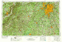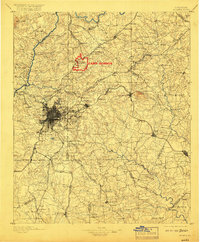
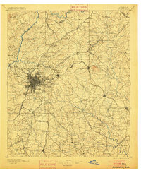
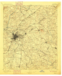
1895 Map of Atlanta
USGS Topo · Published 1917About this map
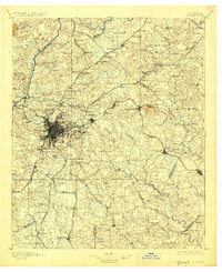
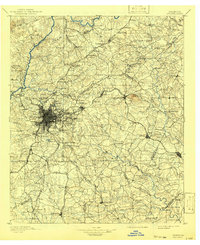
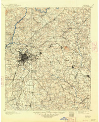
Camp Gordon stands out as a significant military installation in this late 19th-century survey of the Georgia capital and its surroundings. The map documents a dense network of early transportation routes, including the Chattahoochee River crossings at Jett Ferry, Holcomb Ferry, and Pace Ferry, which served as critical nodes before widespread bridging. The urban core of Atlanta is depicted alongside landmark sites such as the Exposition grounds, the McPherson Monument, and the Soldiers Home, reflecting the city's post-war growth and emerging civic identity. To the east, the massive geological profile of Stone Mountain dominates the landscape. The rail infrastructure is remarkably detailed, tracing the Southern RR, Georgia RR, and the Charlotte Air Line RR, which together established the region as a major inland transit hub. Rural life is preserved through labels for family-run operations like Oakley Mill and Browning Store.
Find a feature on this map
186 named features on this map. Tap any name to fly to it.
Don’t see what you’re looking for? This feature index may not catch every label — zoom into the map to look around manually.
Map Details
Editions of this 1895 Atlanta Map
7 editions found

Historical Maps of Atlanta Through Time
8 maps found