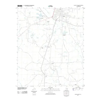
2010 Map of Atlanta South
USGS Topo · Published 2010About this map
The southern outskirts of Atlanta transition into a landscape of small lakes and rural communities in this Cass County survey. Several private and recreational water bodies define the area, including Fin and Feather Club Lake, Lake Arrowhead, and Indian Hills Lake, many of which are managed by significant dam structures. To the south, the timbered terrain is dotted with long-standing settlements like Bivins and Huffins, along with the smaller locales of Oak Grove and Bethsaida.
Find a feature on this map
61 named features on this map. Tap any name to fly to it.
Don’t see what you’re looking for? This feature index may not catch every label — zoom into the map to look around manually.
Map Details
Editions of this 2010 Atlanta South Map
This is the sole edition of this map. No revisions or reprints were ever made.
Other maps of this area

1907 · Atlanta
USGS Topo · 1:62,500

1910 · Linden
USGS Topo · 1:62,500

1910 · Atlanta
USGS Topo · 1:62,500

1944 · Kildare
USGS Topo · 1:62,500

1948 · Kildare
USGS Topo · 1:62,500

1953 · Texarkana
USGS Topo · 1:250,000

1956 · Texarkana
USGS Topo · 1:250,000

1956 · Tyler
USGS Topo · 1:250,000
1962 · McLeod
USGS Topo · 1:24,000

1962 · Lanier
USGS Topo · 1:24,000