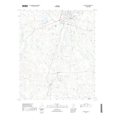
2019 Map of Atlanta South
USGS Topo · Published 2019About this map
The southern portion of Atlanta anchors this landscape in Cass County, where the transition from town streets to the rolling creek bottoms of Northeast Texas is clearly defined. Small rural settlements and crossroads like Bethsaida, Bivins, and Huffins are distributed south of the main city center, connected by a network of farm-to-market roads and county routes. The terrain is notably etched by numerous water bodies and drainage systems, including the meandering Black Bayou, Beach Cr, and Leek Cr.
Find a feature on this map
98 named features on this map. Tap any name to fly to it.
Don’t see what you’re looking for? This feature index may not catch every label — zoom into the map to look around manually.
Map Details
Editions of this 2019 Atlanta South Map
This is the sole edition of this map. No revisions or reprints were ever made.
Other maps of this area

1907 · Atlanta
USGS Topo · 1:62,500

1910 · Linden
USGS Topo · 1:62,500

1910 · Atlanta
USGS Topo · 1:62,500

1944 · Kildare
USGS Topo · 1:62,500

1948 · Kildare
USGS Topo · 1:62,500

1953 · Texarkana
USGS Topo · 1:250,000

1956 · Texarkana
USGS Topo · 1:250,000

1956 · Tyler
USGS Topo · 1:250,000
1962 · McLeod
USGS Topo · 1:24,000

1962 · Lanier
USGS Topo · 1:24,000