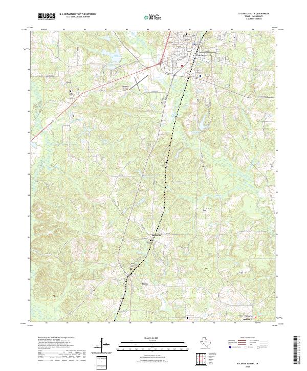
2022 Map of Atlanta South
USGS Topo · Published 2022About this map
Atlanta anchors the northern reaches of this Cass County landscape, where the town grid transitions into a countryside defined by small settlements and family cemeteries. The area around Bivins and Bethsaida reveals a pattern of dispersed rural communities linked by farm roads, with the Bivins Community Cem and Bethsaida Y Cem serving as significant genealogical anchors for local families. The local drainage system, including Black Bayou and Enon Cr, dictates the placement of roads and farm boundaries throughout the territory.
Find a feature on this map
106 named features on this map. Tap any name to fly to it.
Don’t see what you’re looking for? This feature index may not catch every label — zoom into the map to look around manually.
Map Details
Editions of this 2022 Atlanta South Map
This is the sole edition of this map. No revisions or reprints were ever made.
Other maps of this area

1907 · Atlanta
USGS Topo · 1:62,500

1910 · Linden
USGS Topo · 1:62,500

1910 · Atlanta
USGS Topo · 1:62,500

1944 · Kildare
USGS Topo · 1:62,500

1948 · Kildare
USGS Topo · 1:62,500

1953 · Texarkana
USGS Topo · 1:250,000

1956 · Texarkana
USGS Topo · 1:250,000

1956 · Tyler
USGS Topo · 1:250,000
1962 · McLeod
USGS Topo · 1:24,000

1962 · Lanier
USGS Topo · 1:24,000