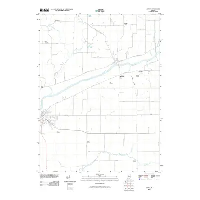
2010 Map of Attica
USGS Topo · Published 2010About this map
The Wabash River carves a diagonal path through this portion of Fountain County, defining the local geography and the placement of historic settlements. Along its banks, the city of Attica serves as a primary hub, while smaller communities like Independence, Riverside, and Maysville Crossing sit positioned near the water's edge. The surrounding landscape is heavily marked by rural heritage, with a high concentration of family and community burial grounds including Bethel Cemetery, Hatton Cemetery, and Ruppert Cemetery scattered across the township grid. Tributaries such as Kickapoo Creek and Big Shawnee Creek drain the agricultural uplands, flowing toward the river valley. The map documents a blend of established river towns and quiet crossroads like Winthrop and Banning Corner, connected by a network of county roads such as E River Rd and E Bethel Rd.
Find a feature on this map
33 named features on this map. Tap any name to fly to it.
Don’t see what you’re looking for? This feature index may not catch every label — zoom into the map to look around manually.
Map Details
Editions of this 2010 Attica Map
This is the sole edition of this map. No revisions or reprints were ever made.
Other maps of this area

1942 · Otterbein
USGS Topo · 1:24,000

1951 · Otterbein
USGS Topo · 1:24,000

1953 · Danville
USGS Topo · 1:250,000

1955 · Danville
USGS Topo · 1:250,000

1956 · Danville
USGS Topo · 1:250,000

1958 · Stonebluff
USGS Topo · 1:24,000

1961 · Chatterton
USGS Topo · 1:24,000

1961 · Pine Village
USGS Topo · 1:24,000

1961 · Otterbein
USGS Topo · 1:24,000

1962 · Williamsport
USGS Topo · 1:24,000