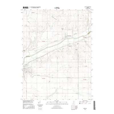
2016 Map of Attica
USGS Topo · Published 2016About this map
The Wabash River carves a diagonal path across this section of Fountain and Warren counties, serving as the primary geographic anchor for several small settlements and rural homesteads. The town of Attica occupies the southwestern corner, while smaller communities like Independence and Riverside sit directly along the river's northern banks. This landscape is a mix of agricultural plateaus and deeply cut drainage patterns, most notably Opossum Hollow and the meandering Big Shawnee Creek to the south. Genealogists will find a high density of small burial grounds scattered throughout the township grids, including Bethel Cem, Clark Cem, and Maysville Cem. The presence of Riley Field near Riley Lake and several named ditches like Clayson Ditch illustrate the long-term modification of the land for local aviation and drainage.
Find a feature on this map
90 named features on this map. Tap any name to fly to it.
Don’t see what you’re looking for? This feature index may not catch every label — zoom into the map to look around manually.
Map Details
Editions of this 2016 Attica Map
This is the sole edition of this map. No revisions or reprints were ever made.
Other maps of this area

1942 · Otterbein
USGS Topo · 1:24,000

1951 · Otterbein
USGS Topo · 1:24,000

1953 · Danville
USGS Topo · 1:250,000

1955 · Danville
USGS Topo · 1:250,000

1956 · Danville
USGS Topo · 1:250,000

1958 · Stonebluff
USGS Topo · 1:24,000

1961 · Chatterton
USGS Topo · 1:24,000

1961 · Pine Village
USGS Topo · 1:24,000

1961 · Otterbein
USGS Topo · 1:24,000

1962 · Williamsport
USGS Topo · 1:24,000