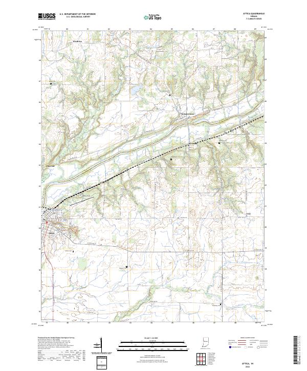
2022 Map of Attica
USGS Topo · Published 2022About this map
The Wabash River carves a deep southwest diagonal across this portion of Indiana, serving as the physical boundary between Warren Co and Fountain Co. Along its banks, the settlement of Attica serves as a primary hub, showing a grid of streets including Main St and Council St near Riley Lake. Smaller riverfront communities like Riverside and Independence illustrate the historic importance of the river corridor for local development and transit.
Find a feature on this map
84 named features on this map. Tap any name to fly to it.
Don’t see what you’re looking for? This feature index may not catch every label — zoom into the map to look around manually.
Map Details
Editions of this 2022 Attica Map
This is the sole edition of this map. No revisions or reprints were ever made.
Other maps of this area

1942 · Otterbein
USGS Topo · 1:24,000

1951 · Otterbein
USGS Topo · 1:24,000

1953 · Danville
USGS Topo · 1:250,000

1955 · Danville
USGS Topo · 1:250,000

1956 · Danville
USGS Topo · 1:250,000

1958 · Stonebluff
USGS Topo · 1:24,000

1961 · Chatterton
USGS Topo · 1:24,000

1961 · Pine Village
USGS Topo · 1:24,000

1961 · Otterbein
USGS Topo · 1:24,000

1962 · Williamsport
USGS Topo · 1:24,000