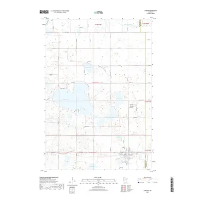
2019 Map of Atwater
USGS Topo · Published 2019About this map
Atwater serves as the primary hub in this portion of Kandiyohi County, situated at the intersection of several significant local transit corridors including Co Hwy 2 and Co Hwy 4. The landscape is defined by its numerous glacial lakes and wetlands, most notably Diamond Lake and Sperry Lake, which influence the layout of rural routes like Diamond Shore Rd and Sperry Lake Rd. Genealogical data is abundant here, with a high density of burial grounds such as Bethlehem Cem, Saint Marys Cem, and Saint John Evangelical Lutheran Cem clustered near the township and along the county border. The northern reach is crossed by the Middle Fork Crow River, while the southern area features smaller water bodies including Summit Lake and Tadd Lake. This survey illustrates a modern rural-residential pattern where farmsteads and open areas like Pagel's Field sit adjacent to growing lakeside developments.
Find a feature on this map
79 named features on this map. Tap any name to fly to it.
Don’t see what you’re looking for? This feature index may not catch every label — zoom into the map to look around manually.
Map Details
Editions of this 2019 Atwater Map
This is the sole edition of this map. No revisions or reprints were ever made.
Other maps of this area

1953 · Saint Cloud
USGS Topo · 1:250,000

1956 · Atwater
USGS Topo · 1:62,500

1957 · Saint Cloud
USGS Topo · 1:250,000

1958 · Saint Cloud
USGS Topo · 1:250,000

1967 · Grove City
USGS Topo · 1:24,000

1967 · Lake Koronis
USGS Topo · 1:24,000
1967 · Rosendale
USGS Topo · 1:24,000

1967 · Hawick
USGS Topo · 1:24,000
1967 · New London
USGS Topo · 1:24,000
1982 · Lake Elizabeth
USGS Topo · 1:24,000