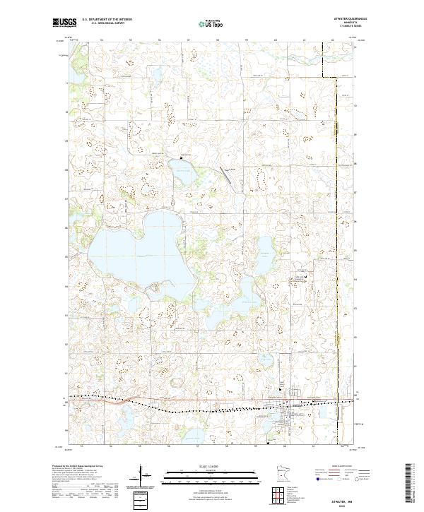
2022 Map of Atwater
USGS Topo · Published 2022About this map
The city of Atwater anchors the southern portion of this Kandiyohi County landscape, situated along the BNSF Railway corridor. This area is defined by a dense network of glacial lakes and wetlands, most notably the expansive Diamond Lake and the smaller Sperry Lake, Schultz Lake, and Wheeler Lake to the east. The terrain is relatively level, punctuated by water bodies and the Middle Fork Crow River which cuts across the northeast corner near the Meeker County line.
Find a feature on this map
64 named features on this map. Tap any name to fly to it.
Don’t see what you’re looking for? This feature index may not catch every label — zoom into the map to look around manually.
Map Details
Editions of this 2022 Atwater Map
This is the sole edition of this map. No revisions or reprints were ever made.
Other maps of this area

1953 · Saint Cloud
USGS Topo · 1:250,000

1956 · Atwater
USGS Topo · 1:62,500

1957 · Saint Cloud
USGS Topo · 1:250,000

1958 · Saint Cloud
USGS Topo · 1:250,000

1967 · Grove City
USGS Topo · 1:24,000

1967 · Lake Koronis
USGS Topo · 1:24,000
1967 · Rosendale
USGS Topo · 1:24,000

1967 · Hawick
USGS Topo · 1:24,000
1967 · New London
USGS Topo · 1:24,000
1982 · Lake Elizabeth
USGS Topo · 1:24,000