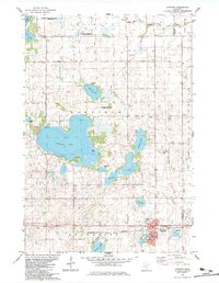
1983 Map of Atwater
USGS Topo · Published 1983About this map
Atwater serves as the primary hub in this corner of Kandiyohi County, situated along the Burlington Northern railroad line. The landscape is defined by an extensive network of prairie potholes and larger bodies of water including Diamond Lake, Sperry Lake, and Wheeler Lake. This 1980s-era documentation highlights a significant commitment to conservation, shown through the large Dietrich Lange State Wildlife Management Area in the northwest and several tracts of the National Waterfowl Production Area scattered throughout the townships of Harrison and Genessee.
Find a feature on this map
45 named features on this map. Tap any name to fly to it.
Don’t see what you’re looking for? This feature index may not catch every label — zoom into the map to look around manually.
Map Details
Editions of this 1983 Atwater Map
This is the sole edition of this map. No revisions or reprints were ever made.
Other maps of this area

1953 · Saint Cloud
USGS Topo · 1:250,000

1956 · Atwater
USGS Topo · 1:62,500

1957 · Saint Cloud
USGS Topo · 1:250,000

1958 · Saint Cloud
USGS Topo · 1:250,000

1967 · Grove City
USGS Topo · 1:24,000

1967 · Lake Koronis
USGS Topo · 1:24,000
1967 · Rosendale
USGS Topo · 1:24,000

1967 · Hawick
USGS Topo · 1:24,000
1967 · New London
USGS Topo · 1:24,000
1982 · Lake Elizabeth
USGS Topo · 1:24,000