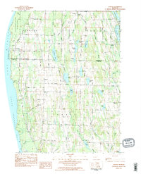
1983 Map of Atwood
USGS Topo · Published 1984About this map
Fishermans Island State Park stretches along the coastline of Lake Michigan and Grand Traverse Bay, anchoring a landscape where the northern Michigan shoreline meets inland glacial lakes. In the early 1980s, this area of Antrim and Charlevoix Counties maintained a rural character defined by small settlements like Norwood and Ellsworth. The interior is densely pocketed with water bodies, including the centrally located Little Torch Lake and Mud Lake, and the larger Lake Marion to the east. A network of local roads such as Dixie Highway and Bell Tower Road connects these waters to historic community landmarks, including The Wayside Chapel and the Antrim Cem. The presence of numerous gravel pits and the Antrim Dells Golf Course suggests a terrain utilized for both local industry and the region's burgeoning recreation economy.
Find a feature on this map
90 named features on this map. Tap any name to fly to it.
Don’t see what you’re looking for? This feature index may not catch every label — zoom into the map to look around manually.
Map Details
Editions of this 1983 Atwood Map
2 editions found
Other maps of this area

1954 · Central Lake
USGS Topo · 1:62,500

1954 · Charlevoix
USGS Topo · 1:62,500

1955 · Cheboygan
USGS Topo · 1:250,000

1958 · Cheboygan
USGS Topo · 1:250,000

1958 · Bayshore
USGS Topo · 1:62,500

1961 · Boyne City
USGS Topo · 1:62,500

1975 · Boyne City NW
USGS Topo · 1:24,000
1983 · Ellsworth
USGS Topo · 1:25,000
1983 · Atwood
USGS Topo · 1:24,000
1983 · Central Lake
USGS Topo · 1:25,000