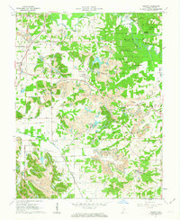
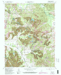
1961 Map of Augusta
USGS Topo · Published 1963About this map
Pike County industrial and forest lands converge in this early 1960s survey, where the heavy footprint of surface mining marks the terrain between Augusta and Hartwell. Multiple areas are designated as Strip Mine, while the Blackfoot Mine sits centrally, illustrating the importance of coal to the local economy. In contrast to these excavated landscapes, the Pike County State Forest and its Lookout Tower dominate the northeastern corner, preserving a section of the Patoka River watershed.
Find a feature on this map
46 named features on this map. Tap any name to fly to it.
Don’t see what you’re looking for? This feature index may not catch every label — zoom into the map to look around manually.
Map Details
Editions of this 1961 Augusta Map
5 editions found
Other maps of this area

1900 · De Gonia Springs
USGS Topo · 1:62,500

1902 · Ditney
USGS Topo · 1:125,000

1902 · Degonia Springs
USGS Topo · 1:62,500

1902 · Boonville
USGS Topo · 1:62,500

1903 · Velpen
USGS Topo · 1:62,500

1903 · Petersburg
USGS Topo · 1:62,500

1956 · Vincennes
USGS Topo · 1:250,000

1957 · Vincennes
USGS Topo · 1:250,000

1958 · Vincennes
USGS Topo · 1:250,000
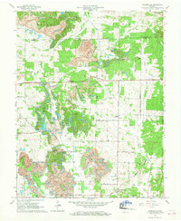
1960 · Folsomville
USGS Topo · 1:24,000