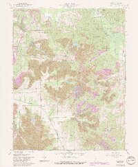
1961 Map of Augusta
USGS Topo · Published 1989About this map
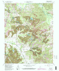
Mining operations and state-managed timberlands define this 1961 landscape in Pike County, as documented in this survey updated for the late 1980s. The region is marked by extensive surface excavations labeled as Strip Mine, notably the Blackfoot Mine, which sit in contrast to the protected acreage of the Pike State Forest and the Patoka State Fish and Wildlife Area. Small rural communities like Augusta and Stendal serve as local anchors, while the Southern Railroad and various old railroad grades reflect the area’s industrial dependence on heavy transport. Small churches and burial grounds, such as St Peters Ch and the Odd Fellows Cem, are scattered throughout the hills, providing valuable data for genealogists. The Patoka River and its tributaries, including the South Fork Patoka River, snake through the terrain, intersecting historic markers like the Treaty Boundary that once partitioned this part of Indiana.
Find a feature on this map
44 named features on this map. Tap any name to fly to it.
Don’t see what you’re looking for? This feature index may not catch every label — zoom into the map to look around manually.
Map Details
Editions of this 1961 Augusta Map
5 editions found
Other maps of this area

1900 · De Gonia Springs
USGS Topo · 1:62,500

1902 · Ditney
USGS Topo · 1:125,000

1902 · Degonia Springs
USGS Topo · 1:62,500

1902 · Boonville
USGS Topo · 1:62,500

1903 · Velpen
USGS Topo · 1:62,500

1903 · Petersburg
USGS Topo · 1:62,500

1956 · Vincennes
USGS Topo · 1:250,000

1957 · Vincennes
USGS Topo · 1:250,000

1958 · Vincennes
USGS Topo · 1:250,000
1960 · Folsomville
USGS Topo · 1:24,000