
1957 Map of Augusta
USGS Topo · Published 1966About this map
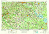
The Savannah River Plant dominates the southwestern quadrant of this mid-century landscape, signifying a massive shift toward nuclear infrastructure along the Savannah River. The map details a sprawling region of the Carolinas and Georgia where agricultural settlements like Orangeburg and Bamberg are interconnected by an extensive rail network featuring the Southern Railway and Atlantic Coast Line Railroad. To the east, the watery expanse of Lake Marion and Lake Moultrie is fully formed, managed alongside the Santee National Wildlife Refuge.
Find a feature on this map
262 named features on this map. Tap any name to fly to it.
Don’t see what you’re looking for? This feature index may not catch every label — zoom into the map to look around manually.
Map Details
Editions of this 1957 Augusta Map
3 editions found
Other maps of this area

1892 · Mc Cormick
USGS Topo · 1:125,000

1892 · Abbeville
USGS Topo · 1:125,000

1904 · Columbia
USGS Topo · 1:125,000

1908 · Kirksey
USGS Topo · 1:24,000

1912 · Mc Cormick
USGS Topo · 1:125,000

1918 · Walterboro
USGS Topo · 1:62,500

1918 · Varnville
USGS Topo · 1:62,500

1918 · Cottageville
USGS Topo · 1:62,500

1919 · Ladson
USGS Topo · 1:21,120

1919 · Gough
USGS Topo · 1:62,500