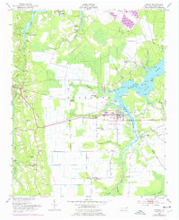
1950 Map of Aurora
USGS Topo · Published 1977About this map
The low-lying coastal plains of Beaufort County come into sharp focus near Aurora, where the South Creek estuary dictates the landscape of the mid-20th century. This area, largely defined by the Rich Land and the expansive Beacham Savanna, shows a network of established rural communities like Bonnerton, Edward, and Idalia. The rail-dependent economy is evident through the Norfolk Southern line and the presence of Guilford Station. The cultural landscape is particularly dense with historic houses of worship and burial grounds, such as Weeping Rachel Ch, St Stephen Ch, and the Whitehill Cem near Durham Creek. These sites, along with the Lookout Tower near Edward and various points along the water like Deephole Pt, provide an intimate look at the infrastructure of the North Carolina Tidewater before more modern developments altered the shorelines.
Find a feature on this map
73 named features on this map. Tap any name to fly to it.
Don’t see what you’re looking for? This feature index may not catch every label — zoom into the map to look around manually.
Map Details
Editions of this 1950 Aurora Map
4 editions found
Other maps of this area

1950 · Vandemere
USGS Topo · 1:24,000

1950 · South Creek
USGS Topo · 1:24,000

1950 · Aurora
USGS Topo · 1:24,000

1950 · Edward
USGS Topo · 1:24,000

1951 · Bath
USGS Topo · 1:24,000

1951 · Ransomville
USGS Topo · 1:24,000

1953 · Blounts Bay
USGS Topo · 1:24,000

1953 · Rocky Mount
USGS Topo · 1:250,000

1954 · Rocky Mount
USGS Topo · 1:250,000
1968 · Bayboro
USGS Topo · 1:24,000