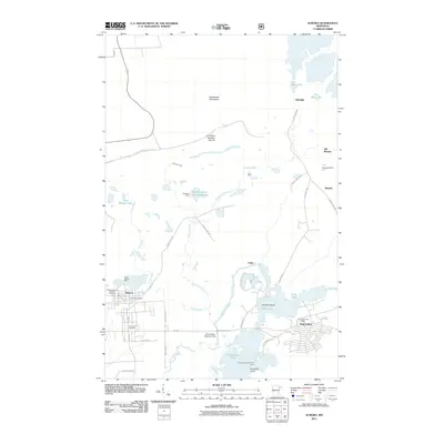
2011 Map of Aurora
USGS Topo · Published 2011About this map
The iron mining landscape of the Mesabi Range is clearly visible on this 2011 survey of the Aurora and Hoyt Lakes area. Large-scale excavations and industrial infrastructure dominate the northern terrain, including the expansive Erie Mine Number One Pit and the East Stephens Settling Basin. To the west, the Saint James Mine sits adjacent to the residential streets of Aurora, where the Czechoslovakian National Cemetery and Forest Hill Cemetery reflect the heritage of the local community.
Find a feature on this map
48 named features on this map. Tap any name to fly to it.
Don’t see what you’re looking for? This feature index may not catch every label — zoom into the map to look around manually.
Map Details
Editions of this 2011 Aurora Map
This is the sole edition of this map. No revisions or reprints were ever made.
Other maps of this area

1949 · Aurora
USGS Topo · 1:24,000

1949 · Isaac Lake
USGS Topo · 1:24,000

1949 · Allen
USGS Topo · 1:24,000

1949 · Embarrass
USGS Topo · 1:24,000

1950 · Isaac Lake
USGS Topo · 1:24,000

1950 · Embarrass
USGS Topo · 1:24,000

1950 · Allen
USGS Topo · 1:24,000

1950 · Aurora
USGS Topo · 1:24,000

1950 · Biwabik
USGS Topo · 1:24,000

1950 · Biwabik NE
USGS Topo · 1:24,000