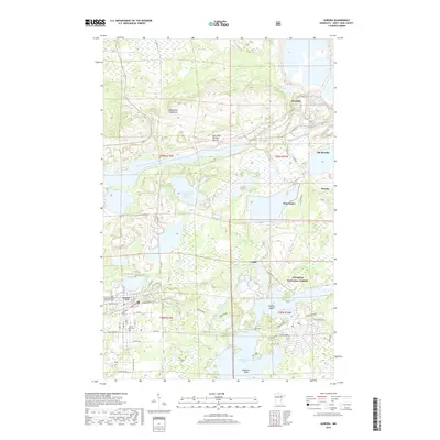
2019 Map of Aurora
USGS Topo · Published 2019About this map
Aurora and Hoyt Lakes anchor this survey of the Mesabi Range, revealing a landscape defined by its industrial heritage and transition into the Superior National Forest. The map documents the extensive footprint of the iron industry, most notably the Erie Mine Number One Pit and associated water management features like Erie Basin One and Erie Basin Two. These excavations sit adjacent to the Embarrass Mountains, contrasting the natural topography with large-scale human intervention.
Find a feature on this map
43 named features on this map. Tap any name to fly to it.
Don’t see what you’re looking for? This feature index may not catch every label — zoom into the map to look around manually.
Map Details
Editions of this 2019 Aurora Map
This is the sole edition of this map. No revisions or reprints were ever made.
Other maps of this area

1949 · Aurora
USGS Topo · 1:24,000

1949 · Isaac Lake
USGS Topo · 1:24,000

1949 · Allen
USGS Topo · 1:24,000

1949 · Embarrass
USGS Topo · 1:24,000

1950 · Isaac Lake
USGS Topo · 1:24,000

1950 · Embarrass
USGS Topo · 1:24,000

1950 · Allen
USGS Topo · 1:24,000

1950 · Aurora
USGS Topo · 1:24,000

1950 · Biwabik
USGS Topo · 1:24,000

1950 · Biwabik NE
USGS Topo · 1:24,000