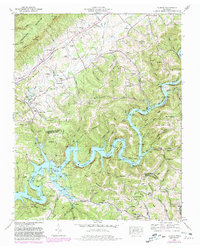
1952 Map of Ausmus
USGS Topo · Published 1980About this map
The Powell River meanders through the heart of this landscape, forming the deep, complex fingers of Norris Lake as it reaches into the valleys of Claiborne and Union Counties. This mid-century survey reveals a rural society defined by its waterways and ridges, where the high crest of Cumberland Mountain looms to the northwest and the Backbone ridge runs parallel to the river's path. Small agricultural and industrial nodes like Speedwell and Norton anchor the area, while historical milling operations such as Leach Mill and Russell Mill mark the sites of early local enterprise.
Find a feature on this map
84 named features on this map. Tap any name to fly to it.
Don’t see what you’re looking for? This feature index may not catch every label — zoom into the map to look around manually.
Map Details
Editions of this 1952 Ausmus Map
4 editions found
Other maps of this area

1886 · Cumberland Gap
USGS Topo · 1:125,000

1888 · Cumberland Gap
USGS Topo · 1:125,000

1891 · Cumberland Gap
USGS Topo · 1:125,000

1897 · Maynardville
USGS Topo · 1:125,000

1900 · Maynardville
USGS Topo · 1:125,000

1903 · Middlesboro
USGS Topo · 1:48,000

1927 · Middlesboro
USGS Topo · 1:62,500

1930 · Middlesboro
USGS Topo · 1:62,500

1935 · Mingo Mountains
USGS Topo · 1:24,000

1935 · Cumberland Gap
USGS Topo · 1:24,000