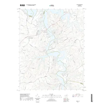
2019 Map of Austin
USGS Topo · Published 2019About this map
Barren River Lake dominates the central landscape of this Barren County region, its winding shoreline creating numerous inlets and peninsulas throughout the topography. The settlement of Austin serves as a local hub on the eastern side, adjacent to Austin Cem, while the communities of Cedar Springs and Maynard anchor the western and southern reaches. The drainage pattern is highly defined by the intricate networks of Peter Creek, Canoe Cr, and Walnut Cr, which carve through the land before meeting the lake.
Find a feature on this map
95 named features on this map. Tap any name to fly to it.
Don’t see what you’re looking for? This feature index may not catch every label — zoom into the map to look around manually.
Map Details
Editions of this 2019 Austin Map
This is the sole edition of this map. No revisions or reprints were ever made.
Other maps of this area

1926 · Scottsville
USGS Topo · 1:62,500

1931 · Lafayette
USGS Topo · 1:62,500

1931 · Red Boiling Springs
USGS Topo · 1:62,500

1953 · Tracy
USGS Topo · 1:24,000

1953 · Glasgow South
USGS Topo · 1:24,000

1954 · Austin
USGS Topo · 1:24,000

1954 · Fountain Run
USGS Topo · 1:24,000

1954 · Petroleum
USGS Topo · 1:24,000

1954 · Scottsville
USGS Topo · 1:24,000
1954 · Meador
USGS Topo · 1:24,000