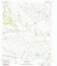
1965 Map of Avalon
USGS Topo · Published 1987About this map
The community of Avalon serves as a central hub in this mid-1960s survey of southeastern Ellis County, characterized by a complex network of prairie waterways and agricultural fence lines. The landscape is deeply defined by the winding course of Chambers Creek and its many tributaries, including Big Onion Creek and Mill Creek, which flow toward the border with Navarro County. Local history is anchored by family-named landmarks and small burial grounds such as Dean Cem, Hughes Cem, and Maloney Cem, providing essential points of reference for genealogical research in this rural Texas corridor.
Find a feature on this map
25 named features on this map. Tap any name to fly to it.
Don’t see what you’re looking for? This feature index may not catch every label — zoom into the map to look around manually.
Map Details
Editions of this 1965 Avalon Map
2 editions found
Other maps of this area

1954 · Dallas
USGS Topo · 1:250,000

1956 · Ennis
USGS Topo · 1:62,500

1958 · Dallas
USGS Topo · 1:250,000

1960 · Boz
USGS Topo · 1:24,000

1961 · Forreston
USGS Topo · 1:24,000

1962 · Ennis West
USGS Topo · 1:24,000

1962 · Cryer Creek
USGS Topo · 1:24,000
1965 · Avalon
USGS Topo · 1:24,000
1965 · Blooming Grove
USGS Topo · 1:24,000
1965 · Italy
USGS Topo · 1:24,000