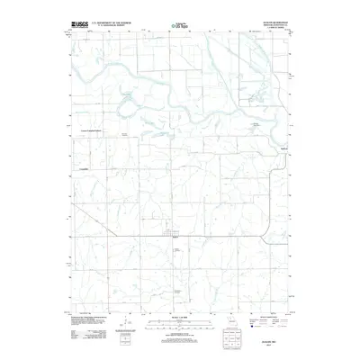
2012 Map of Avalon
USGS Topo · Published 2012About this map
Avalon serves as a central hub for this rural Livingston County landscape, situated at the intersection of local routes like Locust St and Liv 3599. The geography is defined by a dense network of waterways, most notably the meandering Grand River and its various tributaries, including Medicine Creek and Muddy Creek. The prevalence of small, named water bodies like Custer Lake, Billy Lake, and McKenny Lake suggests a region with significant low-lying wetland or floodplain characteristics, further evidenced by the location of Shields Lake Dam. For those researching family history, several local landmarks remain documented on the map, such as the Corner Campbell School and the Burnside Cemetery. The settlement at Bedford on the eastern edge and the location of Cavendish to the west provide historical anchor points for understanding the distribution of rural residences and infrastructure throughout the early 21st century.
Find a feature on this map
53 named features on this map. Tap any name to fly to it.
Don’t see what you’re looking for? This feature index may not catch every label — zoom into the map to look around manually.
Map Details
Editions of this 2012 Avalon Map
This is the sole edition of this map. No revisions or reprints were ever made.
Other maps of this area

1921 · Chillicothe
USGS Topo · 1:62,500

1923 · Chillicothe
USGS Topo · 1:62,500

1924 · Dawn
USGS Topo · 1:62,500

1924 · Chula
USGS Topo · 1:62,500

1924 · Hale
USGS Topo · 1:62,500

1947 · Chula
USGS Topo · 1:62,500

1950 · Coloma
USGS Topo · 1:24,000

1950 · Hale
USGS Topo · 1:24,000

1951 · Hale
USGS Topo · 1:24,000

1951 · Utica
USGS Topo · 1:62,500