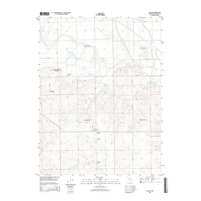
2015 Map of Avalon
USGS Topo · Published 2015About this map
The Grand River and its meandering tributaries, including Medicine Creek and Muddy Cr, define the drainage patterns of this rural Livingston County landscape. The settlement of Avalon serves as a local hub, situated at the intersection of Locust St and Washington St, while the community of Cavendish lies to the northwest. This area exhibits a typical midwestern township and range grid, where many of the rural roads like 304th and 320th follow section lines established during the early land surveys of T57N and T56N.
Find a feature on this map
38 named features on this map. Tap any name to fly to it.
Don’t see what you’re looking for? This feature index may not catch every label — zoom into the map to look around manually.
Map Details
Editions of this 2015 Avalon Map
This is the sole edition of this map. No revisions or reprints were ever made.
Other maps of this area

1921 · Chillicothe
USGS Topo · 1:62,500

1923 · Chillicothe
USGS Topo · 1:62,500

1924 · Dawn
USGS Topo · 1:62,500

1924 · Chula
USGS Topo · 1:62,500

1924 · Hale
USGS Topo · 1:62,500

1947 · Chula
USGS Topo · 1:62,500

1950 · Coloma
USGS Topo · 1:24,000

1950 · Hale
USGS Topo · 1:24,000

1951 · Hale
USGS Topo · 1:24,000

1951 · Utica
USGS Topo · 1:62,500