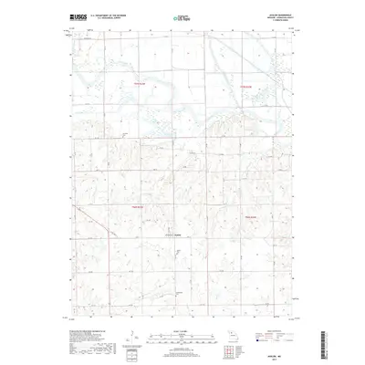
2017 Map of Avalon
USGS Topo · Published 2017About this map
Avalon sits at the heart of this Livingston County landscape, situated where the high ground transitions toward the winding corridor of the Grand River. This 2017 survey reveals a rural settlement pattern defined by agricultural tracts and a series of watercourses, including the confluence-bound Medicine Creek and Wolf Grove Cr. The map's detailed road network, ranging from State Hwy H to numerous local routes like Liv 304, connects several significant historical sites. Researchers will find the Avalon Cem, Arkadelphia Cem, and Burnside Cem, which serve as vital markers for local family history. The northern portion of the quadrangle is dominated by the river's floodplains, featuring oxbow-adjacent water bodies such as Billy Lake and McKenny Lake, illustrating the dynamic nature of the river valley's hydrology in this part of Missouri.
Find a feature on this map
51 named features on this map. Tap any name to fly to it.
Don’t see what you’re looking for? This feature index may not catch every label — zoom into the map to look around manually.
Map Details
Editions of this 2017 Avalon Map
This is the sole edition of this map. No revisions or reprints were ever made.
Other maps of this area

1921 · Chillicothe
USGS Topo · 1:62,500

1923 · Chillicothe
USGS Topo · 1:62,500

1924 · Dawn
USGS Topo · 1:62,500

1924 · Chula
USGS Topo · 1:62,500

1924 · Hale
USGS Topo · 1:62,500

1947 · Chula
USGS Topo · 1:62,500

1950 · Coloma
USGS Topo · 1:24,000

1950 · Hale
USGS Topo · 1:24,000

1951 · Hale
USGS Topo · 1:24,000

1951 · Utica
USGS Topo · 1:62,500