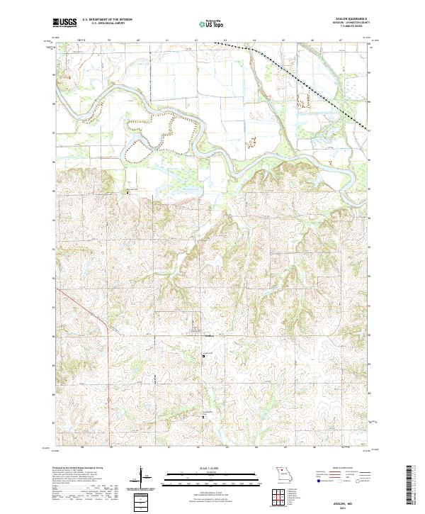
2021 Map of Avalon
USGS Topo · Published 2021About this map
Avalon sits at the intersection of State Hwy H and Hwy J, serving as the central hub of this Missouri landscape. The terrain is defined by the winding course of the Grand River, which meanders through the northern half of the sheet, joined by tributaries like Medicine Creek and Wolf Grove Cr. These watercourses create a complex drainage pattern that has shaped the local agriculture and road networks, visible in the way Liv 302 and Liv 246 navigate the river's bends. Genealogists will find significant local history at the Avalon Cem, located just south of the settlement, as well as the outlying Burnside Cem and Arkadelphia Cem. The map reveals a transition from the alluvial floodplains of Billy Lake and McKenny Lake to the higher ground marked by ridges and secondary streams like Johnson Cr.
Find a feature on this map
49 named features on this map. Tap any name to fly to it.
Don’t see what you’re looking for? This feature index may not catch every label — zoom into the map to look around manually.
Map Details
Editions of this 2021 Avalon Map
This is the sole edition of this map. No revisions or reprints were ever made.
Other maps of this area

1921 · Chillicothe
USGS Topo · 1:62,500

1923 · Chillicothe
USGS Topo · 1:62,500

1924 · Dawn
USGS Topo · 1:62,500

1924 · Chula
USGS Topo · 1:62,500

1924 · Hale
USGS Topo · 1:62,500

1947 · Chula
USGS Topo · 1:62,500

1950 · Coloma
USGS Topo · 1:24,000

1950 · Hale
USGS Topo · 1:24,000

1951 · Hale
USGS Topo · 1:24,000

1951 · Utica
USGS Topo · 1:62,500