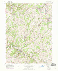
1954 Map of Avella
USGS Topo · Published 1969About this map
Avella and the surrounding townships of Jefferson and Cross Creek define this landscape during a period of transition in Washington County. The terrain is marked by industrial activity, particularly the strip mines north of Eldersville and near Studa. The confluence of the North Fork and South Fork into Cross Creek creates a winding valley floor where settlements like Browntown and P and W Patch took root alongside the rail infrastructure of the Norfolk And Western railroad.
Find a feature on this map
38 named features on this map. Tap any name to fly to it.
Don’t see what you’re looking for? This feature index may not catch every label — zoom into the map to look around manually.
Map Details
Editions of this 1954 Avella Map
Other maps of this area

1902 · Wheeling
USGS Topo · 1:62,500

1904 · Steubenville
USGS Topo · 1:62,500

1904 · Burgettstown
USGS Topo · 1:62,500

1906 · Burgettstown
USGS Topo · 1:62,500

1907 · Claysville
USGS Topo · 1:62,500

1935 · Wheeling
USGS Topo · 1:62,500

1935 · Steubenville
USGS Topo · 1:62,500

1942 · Wheeling
USGS Topo · 1:62,500

1942 · Steubenville
USGS Topo · 1:62,500

1951 · Canton
USGS Topo · 1:250,000
Featured Places
- Cross Creek Township, PA
- Independence Township, PA
- Jefferson Township, PA
- Hanover Township, PA
- Smith Township, PA