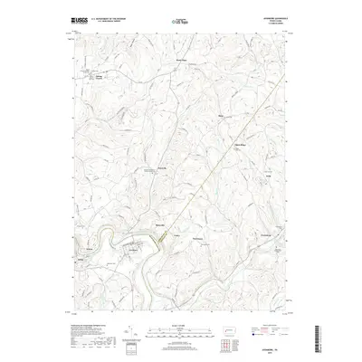
2019 Map of Avonmore
USGS Topo · Published 2019About this map
The Kiskiminetas River carves a sharp, winding boundary through this Pennsylvania landscape, where the borders of Westmoreland, Armstrong, and Indiana counties meet. This modern survey reflects a settlement pattern defined by small villages and rural crossroads, with the borough of Avonmore and nearby Salina situated along the river's southern banks. Further inland, the terrain is dotted with older communities such as Elders Ridge, Clarksburg, and Shady Plain, connected by a network of winding roads like Whitetail Ln and Dilick Rd.
Find a feature on this map
120 named features on this map. Tap any name to fly to it.
Don’t see what you’re looking for? This feature index may not catch every label — zoom into the map to look around manually.
Map Details
Editions of this 2019 Avonmore Map
This is the sole edition of this map. No revisions or reprints were ever made.
Other maps of this area

1900 · Latrobe
USGS Topo · 1:62,500

1902 · Latrobe
USGS Topo · 1:62,500

1902 · Elders Ridge
USGS Topo · 1:62,500

1903 · Latrobe
USGS Topo · 1:62,500

1904 · Elders Ridge
USGS Topo · 1:62,500

1904 · Greensburg
USGS Topo · 1:62,500

1906 · Greensburg
USGS Topo · 1:62,500

1907 · Freeport
USGS Topo · 1:62,500

1909 · Freeport
USGS Topo · 1:62,500

1953 · Pittsburgh
USGS Topo · 1:250,000