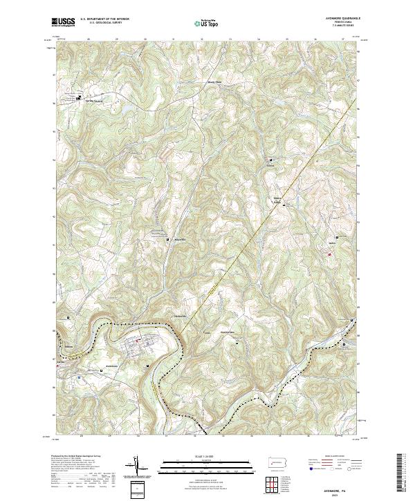
2023 Map of Avonmore
USGS Topo · Published 2023About this map
The Kiskiminetas River carves a deep loop at the tri-county corner where Westmoreland, Armstrong, and Indiana counties meet. The borough of Avonmore sits within this sharp river bend, serving as a primary settlement point for a landscape defined by industrial and agricultural history. To the north and east, the terrain rises into the distinctive Elders Ridge, where smaller communities like Elders Ridge, Maysville, and Iselin follow the winding ridge-top roads and creek valleys.
Find a feature on this map
122 named features on this map. Tap any name to fly to it.
Don’t see what you’re looking for? This feature index may not catch every label — zoom into the map to look around manually.
Map Details
Editions of this 2023 Avonmore Map
This is the sole edition of this map. No revisions or reprints were ever made.
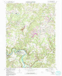
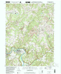
Historical Maps of Shady Plain Through Time
3 maps found