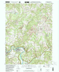
1998 Map of Avonmore
USGS Topo · Published 1999About this map
The Kiskiminetas River carves a deep loop around the borough of Avonmore, serving as the primary geographical and economic focal point for this section of Westmoreland and Armstrong counties. By the late 1990s, the landscape reflects a transition from intensive extraction to reclamation, evidenced by numerous Reclaimed Strip Mines surrounding settlements like Maysville and Olivet. The map documents a scattered rural population served by local institutions such as Spring Church and the Elders Ridge Joint High Sch.
Find a feature on this map
43 named features on this map. Tap any name to fly to it.
Don’t see what you’re looking for? This feature index may not catch every label — zoom into the map to look around manually.
Map Details
Editions of this 1998 Avonmore Map
This is the sole edition of this map. No revisions or reprints were ever made.
Other maps of this area

1900 · Latrobe
USGS Topo · 1:62,500

1902 · Latrobe
USGS Topo · 1:62,500

1902 · Elders Ridge
USGS Topo · 1:62,500

1903 · Latrobe
USGS Topo · 1:62,500

1904 · Elders Ridge
USGS Topo · 1:62,500

1904 · Greensburg
USGS Topo · 1:62,500

1906 · Greensburg
USGS Topo · 1:62,500

1907 · Freeport
USGS Topo · 1:62,500

1909 · Freeport
USGS Topo · 1:62,500

1953 · Pittsburgh
USGS Topo · 1:250,000