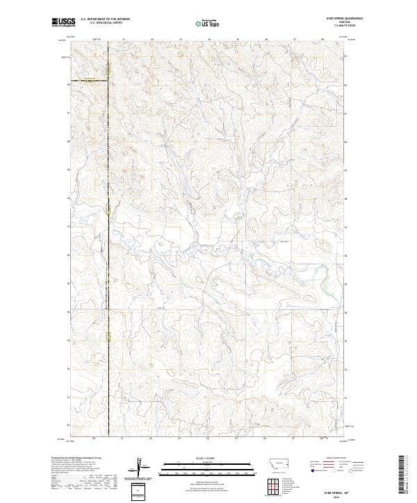
2024 Map of Ayer Spring
USGS Topo · Published 2024About this map
Pennel Creek winds through the heart of this Montana landscape, where the borders of Fallon, Prairie, and Custer counties meet. This area reflects the characteristic open terrain of the region, defined by a network of drainage basins and high-elevation contours. Human influence is marked primarily by sparse ranch roads and livestock trails such as Riley Trl and Westmore Rd, which provide access across the rolling topography. The map illustrates a rural environment where the natural drainage of Dry Fork Creek and various unnamed draws dictate the movement and settlement patterns of this corner of Big Sky Country. It is a detailed look at the public land survey system divisions in a section of the state where topography remains the dominant feature over dense development.
Find a feature on this map
7 named features on this map. Tap any name to fly to it.
Don’t see what you’re looking for? This feature index may not catch every label — zoom into the map to look around manually.
Map Details
Editions of this 2024 Ayer Spring Map
This is the sole edition of this map. No revisions or reprints were ever made.
Other maps of this area

1953 · Miles City
USGS Topo · 1:250,000

1957 · Miles City
USGS Topo · 1:250,000

1958 · Miles City
USGS Topo · 1:250,000

1981 · Baker
USGS Topo · 1:100,000

1981 · Mildred NE
USGS Topo · 1:24,000

1981 · Lawrence Creek West
USGS Topo · 1:24,000
1981 · Ismay North
USGS Topo · 1:24,000

1981 · Dorothy Draw
USGS Topo · 1:24,000

1981 · Ayer Spring NE
USGS Topo · 1:24,000

1981 · Ayer Spring
USGS Topo · 1:24,000