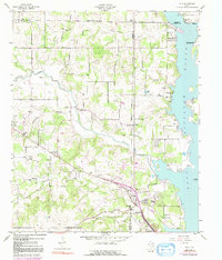
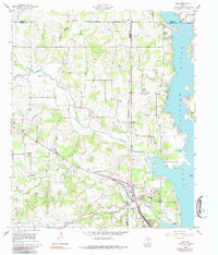
1955 Map of Azle
USGS Topo · Published 1991About this map
The western shoreline of Eagle Mountain Lake defines the eastern edge of this landscape, where the waters of Walnut Creek and Ash Creek meet the reservoir. In the mid-1950s, the growing community of Azle is centered near the intersection of the Jacksboro Highway and Ash Creek Ch. The surrounding countryside across Tarrant, Wise, and Parker counties is dotted with small rural settlements and religious centers such as Wesley Chapel, New Hope, and Peden. Local family history is preserved at the Nelson Cem and Smith-Frazier Cem, while the Eagle Mountain Nat Guard Base sits on the lakefront to the north. The area's transition from rural agriculture to residential development is evident in the appearing clusters at Eagle Acres and Lake Forest, alongside scattered Minnow Ponds and a Drive-in Theater.
Find a feature on this map
46 named features on this map. Tap any name to fly to it.
Don’t see what you’re looking for? This feature index may not catch every label — zoom into the map to look around manually.
Map Details
Editions of this 1955 Azle Map
6 editions found
Other maps of this area

1891 · Weatherford
USGS Topo · 1:125,000

1893 · Weatherford
USGS Topo · 1:125,000

1894 · Fort Worth
USGS Topo · 1:125,000

1924 · Sunset 4-d
USGS Topo · 1:48,000

1930 · Boyd
USGS Topo · 1:62,500

1932 · Springtown
USGS Topo · 1:62,500

1954 · Dallas
USGS Topo · 1:250,000

1954 · Sherman
USGS Topo · 1:250,000

1955 · Avondale
USGS Topo · 1:24,000

1955 · Azle
USGS Topo · 1:24,000