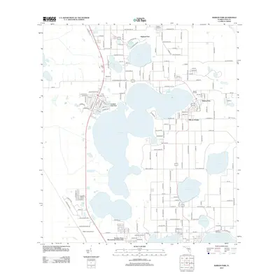
2012 Map of Babson Park
USGS Topo · Published 2012About this map
Crooked Lake serves as the central geographic anchor for this part of Polk County, surrounded by established residential communities and aviation landmarks. The settlement of Babson Park sits on the eastern shore, closely integrated with the campus of Webber College. The landscape is defined by its numerous water bodies, including Lake Easy, Lake Leonore, and Lake Moody, which dictate the winding road patterns and the placement of communities like Hillcrest Heights and Highland Park.
Find a feature on this map
100 named features on this map. Tap any name to fly to it.
Don’t see what you’re looking for? This feature index may not catch every label — zoom into the map to look around manually.
Map Details
Editions of this 2012 Babson Park Map
This is the sole edition of this map. No revisions or reprints were ever made.
Other maps of this area

1952 · Lake Wales
USGS Topo · 1:24,000

1952 · Babson Park
USGS Topo · 1:24,000

1952 · Hesperides
USGS Topo · 1:24,000

1952 · Lake Arbuckle
USGS Topo · 1:24,000

1952 · Lake Weohyakapka
USGS Topo · 1:24,000

1953 · Frostproof
USGS Topo · 1:24,000

1955 · Eloise
USGS Topo · 1:24,000

1955 · Alturas
USGS Topo · 1:24,000

1956 · Bereah
USGS Topo · 1:24,000

1956 · Fort Pierce
USGS Topo · 1:250,000