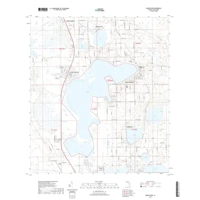
2018 Map of Babson Park
USGS Topo · Published 2018About this map
Crooked Lake dominates this central Florida landscape, serving as a geographic anchor for several communities including Babson Park, Hillcrest Heights, and Crooked Lake Park. The terrain is defined by the Lake Wales Ridge, a prominent geological feature that influences the drainage and settlement patterns of Polk County. To the north, the outskirts of Lake Wales are visible, while the southern portion of the map transition into the northern limits of Frostproof. This area is characterized by a high density of water bodies, such as Lake Easy, Lake Leonore, and Lake Moody, which are interspersed among established residential developments and agricultural lands. Education and aviation are represented by Webber International University near the eastern shore of Crooked Lake and the Lake Clinch Airpark situated further south near Lake Clinch.
Find a feature on this map
146 named features on this map. Tap any name to fly to it.
Don’t see what you’re looking for? This feature index may not catch every label — zoom into the map to look around manually.
Map Details
Editions of this 2018 Babson Park Map
This is the sole edition of this map. No revisions or reprints were ever made.
Other maps of this area

1952 · Lake Wales
USGS Topo · 1:24,000

1952 · Babson Park
USGS Topo · 1:24,000

1952 · Hesperides
USGS Topo · 1:24,000

1952 · Lake Arbuckle
USGS Topo · 1:24,000

1952 · Lake Weohyakapka
USGS Topo · 1:24,000

1953 · Frostproof
USGS Topo · 1:24,000

1955 · Eloise
USGS Topo · 1:24,000

1955 · Alturas
USGS Topo · 1:24,000

1956 · Bereah
USGS Topo · 1:24,000

1956 · Fort Pierce
USGS Topo · 1:250,000