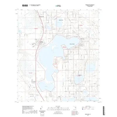
2021 Map of Babson Park
USGS Topo · Published 2021About this map
The Lake Wales Ridge dominates this central Florida landscape, a geologic formation that provides the elevated foundation for the region's citrus groves and residential communities. This contemporary survey captures the intricate network of water bodies that define the area, from the sprawling Crooked Lake and its smaller counterpart, Little Crooked Lake, to Lake Clinch and Lake Moody. The map illustrates the concentration of educational and recreational hubs, including the campuses of Warner University and Webber International University, alongside the Lake Clinch Airpark.
Find a feature on this map
96 named features on this map. Tap any name to fly to it.
Don’t see what you’re looking for? This feature index may not catch every label — zoom into the map to look around manually.
Map Details
Editions of this 2021 Babson Park Map
This is the sole edition of this map. No revisions or reprints were ever made.
Other maps of this area

1952 · Lake Wales
USGS Topo · 1:24,000

1952 · Babson Park
USGS Topo · 1:24,000

1952 · Hesperides
USGS Topo · 1:24,000

1952 · Lake Arbuckle
USGS Topo · 1:24,000

1952 · Lake Weohyakapka
USGS Topo · 1:24,000

1953 · Frostproof
USGS Topo · 1:24,000

1955 · Eloise
USGS Topo · 1:24,000

1955 · Alturas
USGS Topo · 1:24,000

1956 · Bereah
USGS Topo · 1:24,000

1956 · Fort Pierce
USGS Topo · 1:250,000