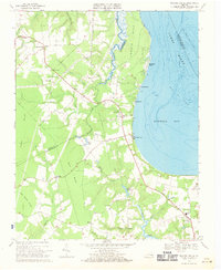
1969 Map of Bacons Castle
USGS Topo · Published 1971About this map
Bacons Castle and the surrounding coastal plain of the Virginia Tidewater are captured here during a period of steady rural continuity. Situated near the border of Surry and Isle of Wight counties, the area is defined by a dense network of slow-moving waterways including Lawnes Creek and the Pagan River, which flow toward the wide expanse of Burwell Bay. The map reveals a landscape deeply rooted in its local institutions, evidenced by numerous country churches such as Mount Nebo Ch and First Gravel Hill Ch, alongside the Hardy Sch. Industry is localized and tied to the land, shown by a Gravel Pit and Sandpit near Lawson. To the east, the James River shipping lane is marked by the Rock Landing Shoal Channel, highlighting the enduring importance of the river to the regional economy.
Find a feature on this map
47 named features on this map. Tap any name to fly to it.
Don’t see what you’re looking for? This feature index may not catch every label — zoom into the map to look around manually.
Map Details
Editions of this 1969 Bacons Castle Map
Other maps of this area

1907 · Yorktown
USGS Topo · 1:62,500

1919 · Smithfield
USGS Topo · 1:62,500

1919 · Surry
USGS Topo · 1:62,500

1920 · Ivor
USGS Topo · 1:62,500

1943 · Yorktown
USGS Topo · 1:62,500

1943 · Richmond
USGS Topo · 1:250,000

1944 · Yorktown
USGS Topo · 1:24,000

1944 · Smithfield
USGS Topo · 1:24,000

1944 · Raynor
USGS Topo · 1:24,000
1945 · Raynor
USGS Topo · 1:31,680