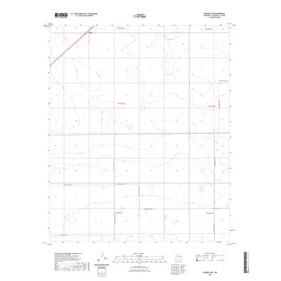
2023 Map of Badger Lake
USGS Topo · Published 2023About this map
The small settlement of Kermit sits at a highway junction in the northern reaches of this Roosevelt County landscape. Established on the high plains of eastern New Mexico, this area is characterized by a grid of rural routes including S Roosevelt Road 24 and S Roosevelt Road 25, which serve the agricultural and ranching parcels of the Llano Estacado. The terrain is marked by seasonal depressions and catchment basins, most notably Badger Lake in the northeastern quadrant. Modern transportation is facilitated by Highway 70, which cuts diagonally across the northwestern corner, and Highway 114, which runs east-to-west across the center. These roads connect the isolated homesteads and township sections, reflecting the enduring 20th-century land use patterns of the region's cattle and farming industry.
Find a feature on this map
17 named features on this map. Tap any name to fly to it.
Don’t see what you’re looking for? This feature index may not catch every label — zoom into the map to look around manually.
Map Details
Editions of this 2023 Badger Lake Map
This is the sole edition of this map. No revisions or reprints were ever made.
Other maps of this area

1954 · Clovis
USGS Topo · 1:250,000

1954 · Brownfield
USGS Topo · 1:250,000

1957 · Portales
USGS Topo · 1:62,500

1958 · Brownfield
USGS Topo · 1:250,000

1958 · Clovis
USGS Topo · 1:250,000

1962 · Brownfield
USGS Topo · 1:250,000

1972 · Dora NW
USGS Topo · 1:24,000

1972 · Dora SW
USGS Topo · 1:24,000

1973 · Lewiston Lake
USGS Topo · 1:24,000

1973 · Floyd SE
USGS Topo · 1:24,000