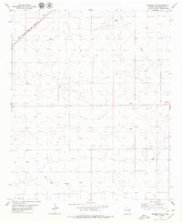
1979 Map of Badger Lake
USGS Topo · Published 1979About this map
Kermit sits in the northwest corner of this Roosevelt County landscape, positioned along the high-plains route of the Atchison Topeka and Santa Fe railroad. The terrain is defined by a series of depressions and ephemeral basins, most notably Badger Lake, Red Lake, and Baker Lake. This late-1970s survey reveals a high density of water infrastructure essential for ranching and industry in eastern New Mexico, with numerous named wells such as Kyle Well, Mc Dorman Well, and Wood Well dotting the sections. Industrial activity is visible through a scattered network including a Gravel Pit, a Drill Hole, and a prominent Pipeline cutting through the eastern sections. These features, alongside many unnamed Tank and Well sites, highlight the intensive management of groundwater and mineral resources in this arid cattle-country environment.
Find a feature on this map
18 named features on this map. Tap any name to fly to it.
Don’t see what you’re looking for? This feature index may not catch every label — zoom into the map to look around manually.
Map Details
Editions of this 1979 Badger Lake Map
This is the sole edition of this map. No revisions or reprints were ever made.
Other maps of this area

1954 · Clovis
USGS Topo · 1:250,000

1954 · Brownfield
USGS Topo · 1:250,000

1957 · Portales
USGS Topo · 1:62,500

1958 · Brownfield
USGS Topo · 1:250,000

1958 · Clovis
USGS Topo · 1:250,000

1962 · Brownfield
USGS Topo · 1:250,000

1972 · Dora NW
USGS Topo · 1:24,000

1972 · Dora SW
USGS Topo · 1:24,000

1973 · Lewiston Lake
USGS Topo · 1:24,000

1973 · Floyd SE
USGS Topo · 1:24,000