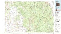
1983 Map of Bailey
USGS Topo · Published 1983About this map
High mountain basins and the steep divides of the Continental Divide define this 1983 overview of central Colorado. The landscape is dominated by the Pike National Forest and the Mount Evans Wilderness, where peaks like Mount Lincoln and Mount Bross exceed fourteen thousand feet. The drainage system of the South Platte River and its North Fork provides a clear look at the region's hydrologic importance, showing major infrastructure including Cheesman Lake and Elevenmile Canyon Reservoir.
Find a feature on this map
159 named features on this map. Tap any name to fly to it.
Don’t see what you’re looking for? This feature index may not catch every label — zoom into the map to look around manually.
Map Details
Editions of this 1983 Bailey Map
2 editions found
Other maps of this area

1889 · Leadville
USGS Topo · 1:125,000

1890 · East Denver
USGS Topo · 1:125,000

1891 · Leadville
USGS Topo · 1:125,000

1893 · Platte Canyon
USGS Topo · 1:125,000

1893 · Colorado Springs
USGS Topo · 1:125,000

1894 · Pikes Peak
USGS Topo · 1:125,000

1894 · Castle Rock
USGS Topo · 1:125,000

1899 · West Denver
USGS Topo · 1:125,000

1901 · Pikes Peak
USGS Topo · 1:125,000

1901 · Pikes Peak
USGS Topo · 1:62,500