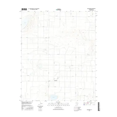
2016 Map of Baileyboro
USGS Topo · Published 2016About this map
Baileyboro sits at the heart of this High Plains landscape in West Texas, surrounded by a precise grid of farm-to-market roads and county lines. This 2016 survey highlights the agrarian layout typical of Bailey County, where the settlement is anchored by the nearby Baileyboro Cem and the seasonal waters of Baileyboro Lake. To the northwest, the large depression of Coyote Lake provides a notable topographical break in the otherwise steady elevation of the Llano Estacado. The road network, including Fm 2487 and Fm 298, reveals the modern logistical skeleton of a region defined by its wide-open spaces and large-scale ranching or farming operations. For those researching local family history, the cemetery and the specific intersections of rural routes provide critical geographic context for early 21st-century property and community boundaries.
Find a feature on this map
26 named features on this map. Tap any name to fly to it.
Don’t see what you’re looking for? This feature index may not catch every label — zoom into the map to look around manually.
Map Details
Editions of this 2016 Baileyboro Map
This is the sole edition of this map. No revisions or reprints were ever made.
Other maps of this area

1954 · Clovis
USGS Topo · 1:250,000

1954 · Brownfield
USGS Topo · 1:250,000

1958 · Brownfield
USGS Topo · 1:250,000

1958 · Clovis
USGS Topo · 1:250,000

1962 · Brownfield
USGS Topo · 1:250,000

1962 · Muleshoe
USGS Topo · 1:24,000

1962 · Needmore
USGS Topo · 1:24,000

1962 · Stegall
USGS Topo · 1:24,000

1962 · Birdwell Ranch
USGS Topo · 1:24,000

1962 · Baileyboro NE
USGS Topo · 1:24,000