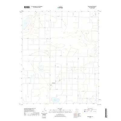
2019 Map of Baileyboro
USGS Topo · Published 2019About this map
Baileyboro sits at the intersection of FM 2487 and Co RD 1202, serving as a focal point in this portion of Bailey County. The landscape is defined by the high plains topography of the Texas Panhandle, characterized by the presence of significant alkaline depressions including Coyote Lake in the northwest and Baileyboro Lake to the south. These natural basins are critical landmarks in an otherwise rectilinear grid of agricultural section roads. For those researching local history or genealogy, the Baileyboro Cem located just south of the main settlement provides a vital link to the area's early residents. The network of farm-to-market roads, such as FM 298, illustrates the region's reliance on efficient transportation for its agricultural economy.
Find a feature on this map
26 named features on this map. Tap any name to fly to it.
Don’t see what you’re looking for? This feature index may not catch every label — zoom into the map to look around manually.
Map Details
Editions of this 2019 Baileyboro Map
This is the sole edition of this map. No revisions or reprints were ever made.
Other maps of this area

1954 · Clovis
USGS Topo · 1:250,000

1954 · Brownfield
USGS Topo · 1:250,000

1958 · Brownfield
USGS Topo · 1:250,000

1958 · Clovis
USGS Topo · 1:250,000

1962 · Brownfield
USGS Topo · 1:250,000

1962 · Muleshoe
USGS Topo · 1:24,000

1962 · Needmore
USGS Topo · 1:24,000

1962 · Stegall
USGS Topo · 1:24,000

1962 · Birdwell Ranch
USGS Topo · 1:24,000

1962 · Baileyboro NE
USGS Topo · 1:24,000