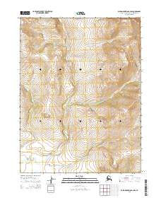
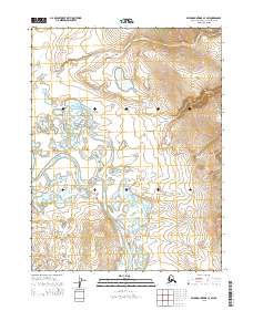
2015 Map of Baird Mountains A-3 NW
USGS Topo · Published 2015About this map
Klery Creek and its network of tributaries define this remote drainage system in the Baird Mountains as it appeared in 2015. The terrain is characterized by a dense system of seasonal and permanent watercourses, including Jack Cr, Bear Cr, and Boldrin Cr, which flow through the sections of Townships 20 and 21 North. This landscape reflects the complex hydrology of the Arctic Northwest, where small headwaters like Martin Cr and Rocky Cr carve through high-elevation contours. The absence of roads or permanent structures on this sheet underscores the wilderness character of the region, emphasizing the primary geographic importance of these named waterways for navigation or land-use studies. Researchers can trace the specific path of Klery Cr as it traverses the boundary between Ranges 7 and 8 West, providing a precise record of the local watershed during this survey period.
Find a feature on this map
11 named features on this map. Tap any name to fly to it.
Don’t see what you’re looking for? This feature index may not catch every label — zoom into the map to look around manually.
Map Details
Editions of this 2015 Baird Mountains A-3 NW Map
This is the sole edition of this map. No revisions or reprints were ever made.
Other maps of this area

1951 · Baird Mountains
USGS Topo · 1:250,000

1955 · Baird Mountains B-3
USGS Topo · 1:63,360

1955 · Baird Mountains A-3
USGS Topo · 1:63,360
1955 · Baird Mountains B-4
USGS Topo · 1:63,360

1955 · Baird Mountains A-4
USGS Topo · 1:63,360

1956 · Baird Mountains
USGS Topo · 1:250,000

1965 · Baird Mountains
USGS Topo · 1:250,000
2015 · Baird Mountains A-4 NE
USGS Topo · 1:25,000
2015 · Baird Mountains A-4 SE
USGS Topo · 1:25,000
2015 · Baird Mountains A-3 SW
USGS Topo · 1:25,000