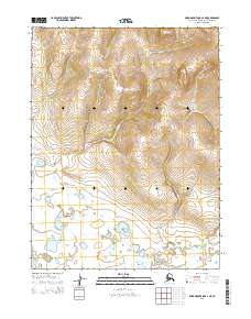
2015 Map of Baird Mountains A-4 NE
USGS Topo · Published 2015About this map
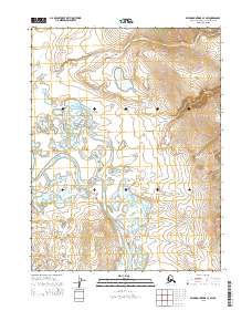
Cross Cr and Boldrin Cr dominate this northern landscape, carving through the high elevations of the Baird Mountains. The terrain transitions from high, contoured peaks in the north to a low-lying, wetland-rich basin in the south, where the drainage of Peluk Cr, Klery Cr, and Timber Cr becomes a complex network of small ponds and interconnected waterways. This 2015 survey reflects the seasonal hydrologic patterns typical of the Alaska-Northwest Arctic Borough, where the runoff from the northern slopes feeds the saturated lowlands. The absence of roads or permanent structures underscores the wilderness character of the region, defined primarily by its watershed boundaries and the Public Land Survey System divisions of T21N and T20N.
Find a feature on this map
10 named features on this map. Tap any name to fly to it.
Don’t see what you’re looking for? This feature index may not catch every label — zoom into the map to look around manually.
Map Details
Editions of this 2015 Baird Mountains A-4 NE Map
This is the sole edition of this map. No revisions or reprints were ever made.
Other maps of this area

1951 · Baird Mountains
USGS Topo · 1:250,000

1955 · Baird Mountains B-3
USGS Topo · 1:63,360

1955 · Baird Mountains A-3
USGS Topo · 1:63,360
1955 · Baird Mountains B-4
USGS Topo · 1:63,360

1955 · Baird Mountains A-4
USGS Topo · 1:63,360

1956 · Baird Mountains
USGS Topo · 1:250,000

1965 · Baird Mountains
USGS Topo · 1:250,000
2015 · Baird Mountains A-4 SE
USGS Topo · 1:25,000
2015 · Baird Mountains A-4 NW
USGS Topo · 1:25,000
2015 · Baird Mountains A-3 SW
USGS Topo · 1:25,000