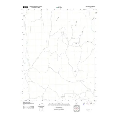
2011 Map of Bald Knoll
USGS Topo · Published 2011About this map
Skutumpah Terrace defines the southern reach of this landscape, where the high desert terrain is carved by a complex network of washes and canyons. The presence of isolated water sources like Spaniard Spring, Fisher Spring, and Fuller Spring suggests a reliance on scattered oases for livestock and range management in an otherwise arid environment. This 2011 survey documents a remote portion of Kane County, characterized by prominent landmarks such as Buck Knoll and Bald Knoll. Transportation in this era is facilitated by rugged routes like N Johnson Canyon Rd and County Hwy-10, which skirt the edges of deep drainages. In the southwest, Kanab Creek passes by a feature known as The Falls, illustrating the sudden shifts in elevation that occur as seasonal waters navigate the canyons of Fisher Canyon and Dry Canyon.
Find a feature on this map
22 named features on this map. Tap any name to fly to it.
Don’t see what you’re looking for? This feature index may not catch every label — zoom into the map to look around manually.
Map Details
Editions of this 2011 Bald Knoll Map
This is the sole edition of this map. No revisions or reprints were ever made.
Other maps of this area

1886 · Kanab
USGS Topo · 1:250,000

1953 · Cedar City
USGS Topo · 1:250,000

1954 · Johnson NE
USGS Topo · 1:24,000

1954 · Johnson
USGS Topo · 1:62,500

1957 · Kanab
USGS Topo · 1:62,500

1958 · Cedar City
USGS Topo · 1:250,000

1958 · Orderville
USGS Topo · 1:62,500

1962 · Cedar City
USGS Topo · 1:250,000

1966 · Alton
USGS Topo · 1:24,000

1966 · Bald Knoll
USGS Topo · 1:24,000