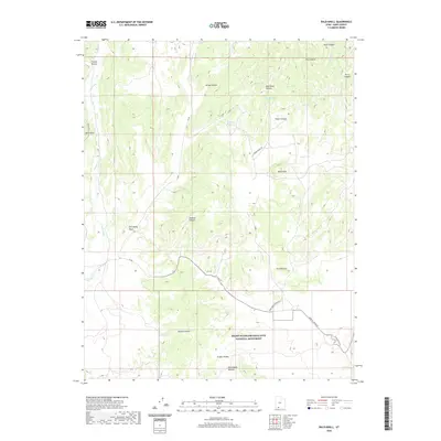
2020 Map of Bald Knoll
USGS Topo · Published 2020About this map
Grand Staircase-Escalante National Monument dominates the southern landscape of this 2020 Kane County survey, revealing a complex network of canyons and terraces. High-elevation features like Bald Knoll and the Skutumpah Terrace define the drainage patterns that feed into Kanab Cr and Thompson Creek. The land is marked by natural springs, including Fisher Spring and Spaniard Spring, which were historically vital for livestock in remote areas like Ford Pasture. Evidence of early and modern infrastructure is visible along the Glendale Bench and Johnson Canyon Rd, where the terrain transitions into deep cuts like Johnson Canyon. Notable topographic landmarks such as The Falls and Sink Valley Wash illustrate the erosive forces that have shaped this high-desert environment over generations, providing a clear view of the area's geological and ranching heritage.
Find a feature on this map
29 named features on this map. Tap any name to fly to it.
Don’t see what you’re looking for? This feature index may not catch every label — zoom into the map to look around manually.
Map Details
Editions of this 2020 Bald Knoll Map
This is the sole edition of this map. No revisions or reprints were ever made.
Other maps of this area

1886 · Kanab
USGS Topo · 1:250,000

1953 · Cedar City
USGS Topo · 1:250,000

1954 · Johnson NE
USGS Topo · 1:24,000

1954 · Johnson
USGS Topo · 1:62,500

1957 · Kanab
USGS Topo · 1:62,500

1958 · Cedar City
USGS Topo · 1:250,000

1958 · Orderville
USGS Topo · 1:62,500

1962 · Cedar City
USGS Topo · 1:250,000

1966 · Alton
USGS Topo · 1:24,000

1966 · Bald Knoll
USGS Topo · 1:24,000