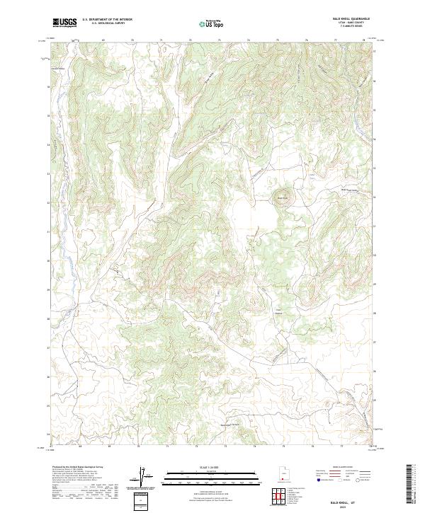
2023 Map of Bald Knoll
USGS Topo · Published 2023About this map
Grand Staircase-Escalante National Monument dominates the southern landscape of this Kane County region, where the distinct geological steps of the Skutumpah Terrace and Glendale Bench meet. The terrain is defined by a series of deep drainage systems including Fisher Canyon and Broad Hollow, which feed toward the primary watercourse of Kanab Creek in the west. A notable hydraulic feature, the Bald Knoll Waterline, traverses the southern portion of the quadrangle, illustrating the infrastructure required to manage water across these arid uplands. Higher elevations are marked by landmarks like Bald Knoll and Buck Knoll, while smaller water sources such as Elbo Spring and Fisher Spring provide critical points of interest in an otherwise high-desert environment. The map details the transition from open grazing land at Ford Pasture to the narrow corridors of Johnson Canyon.
Find a feature on this map
25 named features on this map. Tap any name to fly to it.
Don’t see what you’re looking for? This feature index may not catch every label — zoom into the map to look around manually.
Map Details
Editions of this 2023 Bald Knoll Map
This is the sole edition of this map. No revisions or reprints were ever made.
Other maps of this area

1886 · Kanab
USGS Topo · 1:250,000

1953 · Cedar City
USGS Topo · 1:250,000

1954 · Johnson NE
USGS Topo · 1:24,000

1954 · Johnson
USGS Topo · 1:62,500

1957 · Kanab
USGS Topo · 1:62,500

1958 · Cedar City
USGS Topo · 1:250,000

1958 · Orderville
USGS Topo · 1:62,500

1962 · Cedar City
USGS Topo · 1:250,000

1966 · Alton
USGS Topo · 1:24,000

1966 · Bald Knoll
USGS Topo · 1:24,000