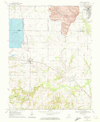
1970 Map of Baldwin
USGS Topo · Published 1972About this map
The boundary of St Clair Co and Randolph Co runs through a landscape defined by heavy industry and rural heritage in the early 1970s. The northern portion is dominated by a massive Strip Mine and the specialized Industrial Railroad, indicating the region's intense mid-century coal extraction. Contrasting with this industrial activity is a significant water project, the Reservoir, complete with its own Substa Powerplant and conveyor system.
Find a feature on this map
26 named features on this map. Tap any name to fly to it.
Don’t see what you’re looking for? This feature index may not catch every label — zoom into the map to look around manually.
Map Details
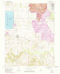
Editions of this 1970 Baldwin Map
2 editions found
Other maps of this area

1910 · Okawville
USGS Topo · 1:62,500

1912 · New Athens
USGS Topo · 1:62,500

1912 · Baldwin
USGS Topo · 1:62,500

1914 · Baldwin
USGS Topo · 1:62,500

1914 · Coulterville
USGS Topo · 1:62,500

1917 · Coulterville
USGS Topo · 1:62,500

1940 · Okawville
USGS Topo · 1:62,500

1942 · Baldwin
USGS Topo · 1:62,500

1954 · New Athens West
USGS Topo · 1:24,000
1954 · New Athens East
USGS Topo · 1:24,000