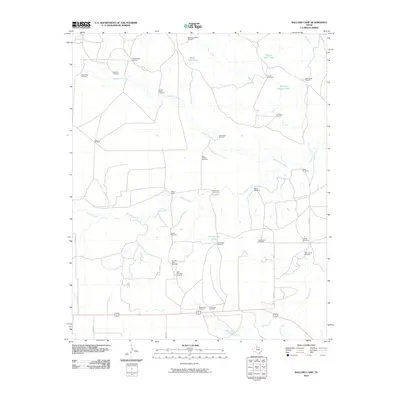
2010 Map of Ballard Camp
USGS Topo · Published 2010About this map
The Middle Pease River winds through this ranching landscape in Motley County, carving a path across terrain defined by local water management and cattle history. The map centers on Ballard Camp, a site connected by Ballard Creek and surrounded by a dense network of private windmills that supported livestock in this arid region. These functional landmarks, bearing names like Big Old Glory Windmill, Stotts Windmill, and the Boxcar Windmill, trace the development of local landholdings and the essential infrastructure of West Texas range life. In the southern reaches, drainage flows toward Tee Pee Creek and Hackberry Creek, while man-made features like the Dry Section Tank and Phone Line Tank highlight the precision required to maintain water security across the sprawling pastures. Roads such as Co RD 231 and Co RD 247 provide the primary access through this remote territory, connecting isolated camp houses and working windmills.
Find a feature on this map
39 named features on this map. Tap any name to fly to it.
Don’t see what you’re looking for? This feature index may not catch every label — zoom into the map to look around manually.
Map Details
Editions of this 2010 Ballard Camp Map
This is the sole edition of this map. No revisions or reprints were ever made.
Other maps of this area

1954 · Lubbock
USGS Topo · 1:250,000

1954 · Plainview
USGS Topo · 1:250,000

1958 · Plainview
USGS Topo · 1:250,000

1966 · Fields Canyon
USGS Topo · 1:24,000

1966 · Matador
USGS Topo · 1:24,000

1966 · Ballard Camp
USGS Topo · 1:24,000

1966 · Tee Pee City
USGS Topo · 1:24,000

1967 · Hornica Creek
USGS Topo · 1:24,000

1967 · Turtle Hole Camp
USGS Topo · 1:24,000

1968 · Roaring Springs
USGS Topo · 1:24,000