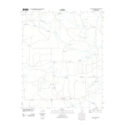
2012 Map of Ballard Camp
USGS Topo · Published 2012About this map
Ballard Camp anchors this West Texas landscape, where the seasonal flow of the Middle Pease River and Ballard Cr defines the local geography. This area of Motley County is a testament to the persistence of ranching and water management on the High Plains, characterized by a dense network of named windmills that serve as vital landmarks. Distinctive names like the Big Old Glory Windmill, Boxcar Windmill, and Beauchumt Windmill indicate specific family claims and historical land divisions. Water conservation is evident through established tanks such as Little Bear Cr Tank and Phone Line Tank, which supplement the natural drainages of Tee Pee Cr and Hackberry Cr. The infrastructure is rounded out by county roads like Co RD-231, providing access to these remote ranching outposts.
Find a feature on this map
40 named features on this map. Tap any name to fly to it.
Don’t see what you’re looking for? This feature index may not catch every label — zoom into the map to look around manually.
Map Details
Editions of this 2012 Ballard Camp Map
This is the sole edition of this map. No revisions or reprints were ever made.
Other maps of this area

1954 · Lubbock
USGS Topo · 1:250,000

1954 · Plainview
USGS Topo · 1:250,000

1958 · Plainview
USGS Topo · 1:250,000

1966 · Fields Canyon
USGS Topo · 1:24,000

1966 · Matador
USGS Topo · 1:24,000

1966 · Ballard Camp
USGS Topo · 1:24,000

1966 · Tee Pee City
USGS Topo · 1:24,000

1967 · Hornica Creek
USGS Topo · 1:24,000

1967 · Turtle Hole Camp
USGS Topo · 1:24,000

1968 · Roaring Springs
USGS Topo · 1:24,000